Satellite Laser Ranging
WTW’s mobile Satellite Laser Ranging (SLR) System integrated in a 20ft Container..
• Direct Drive in both axis
• Rated Torque: 100 Nm both axis
• Peak Torque: 250 Nm both axis
• Velocity: up to 60°/sec
• Elevation: 0° to 90°
• Azimuth: Unlimited (Slipring Assembly)
• Payload: up to 150 kg
• Pointing Accuracy: better 2 µrad
• Blind pointing: 20 µrad
• Coudé Path: 50 mm Diameter
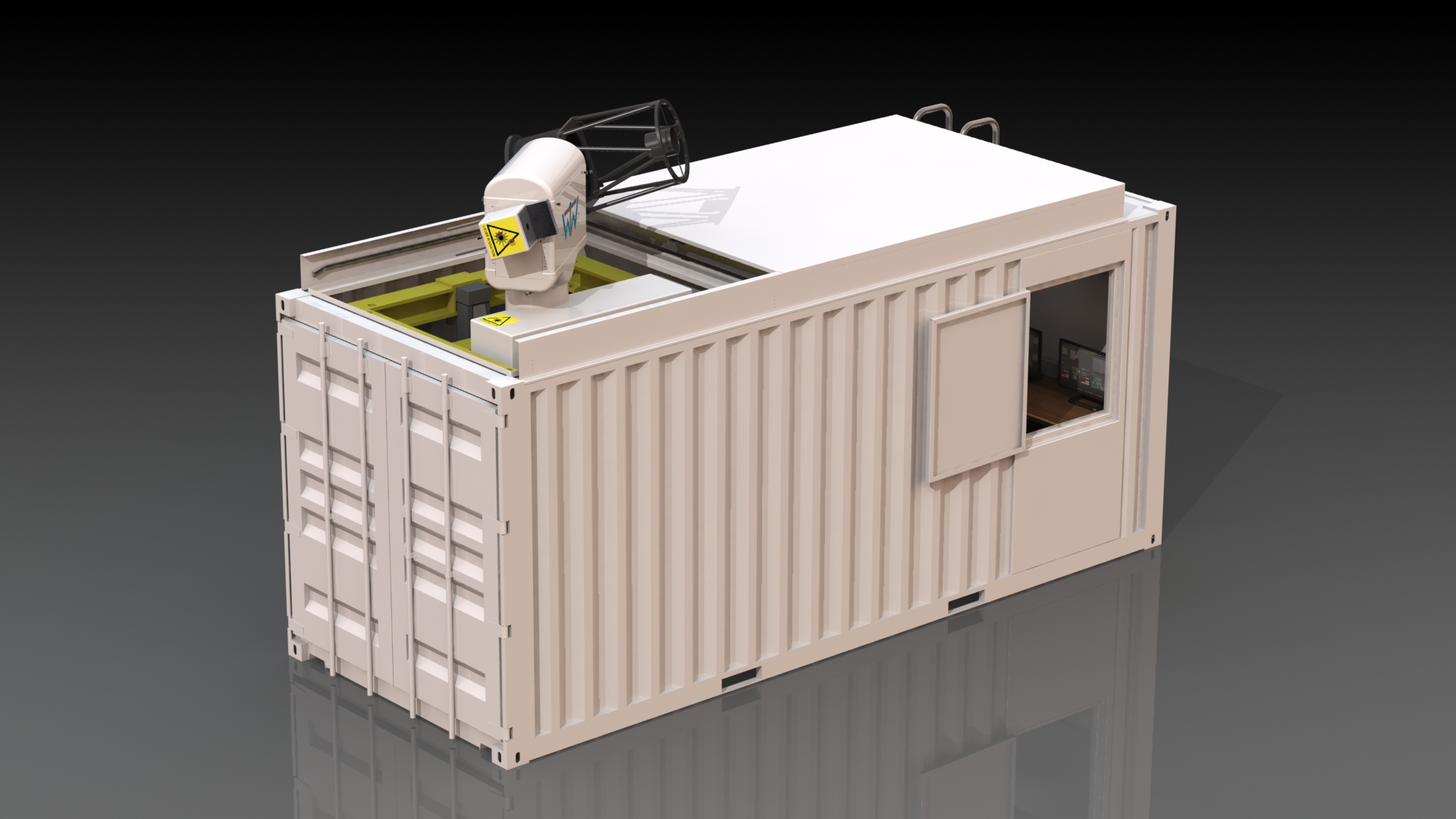

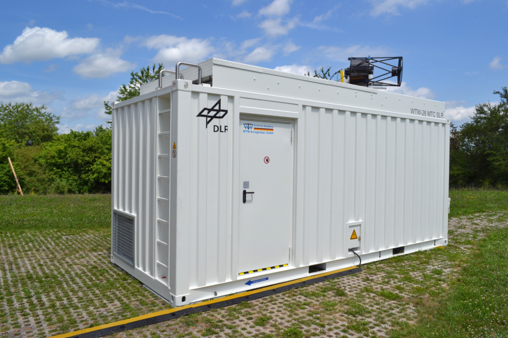
Mobile Telescope Container:
It is a 20ft standard container with an electrical sliding roof on top of the telescope section. The Control room section is about 3.5m x 2.3m with 3 work places. The control room has an air condition . When the sliding roof is closed, the air circulates between control and telescope room. If the sliding roof is opened, the circulation is stopped.
Only when the sliding roof is opened, the lifting segment with the telescope can be driven out to move the telescope over the roof level.
But before that the complete lifting frame move of the container floor by 4 electric lifter to level it out and disconnect it from the container (the lifters are driving through holes in the container floor to the ground). The lifting frame has a weight of about 3t to give a massive foundation for the telescope.
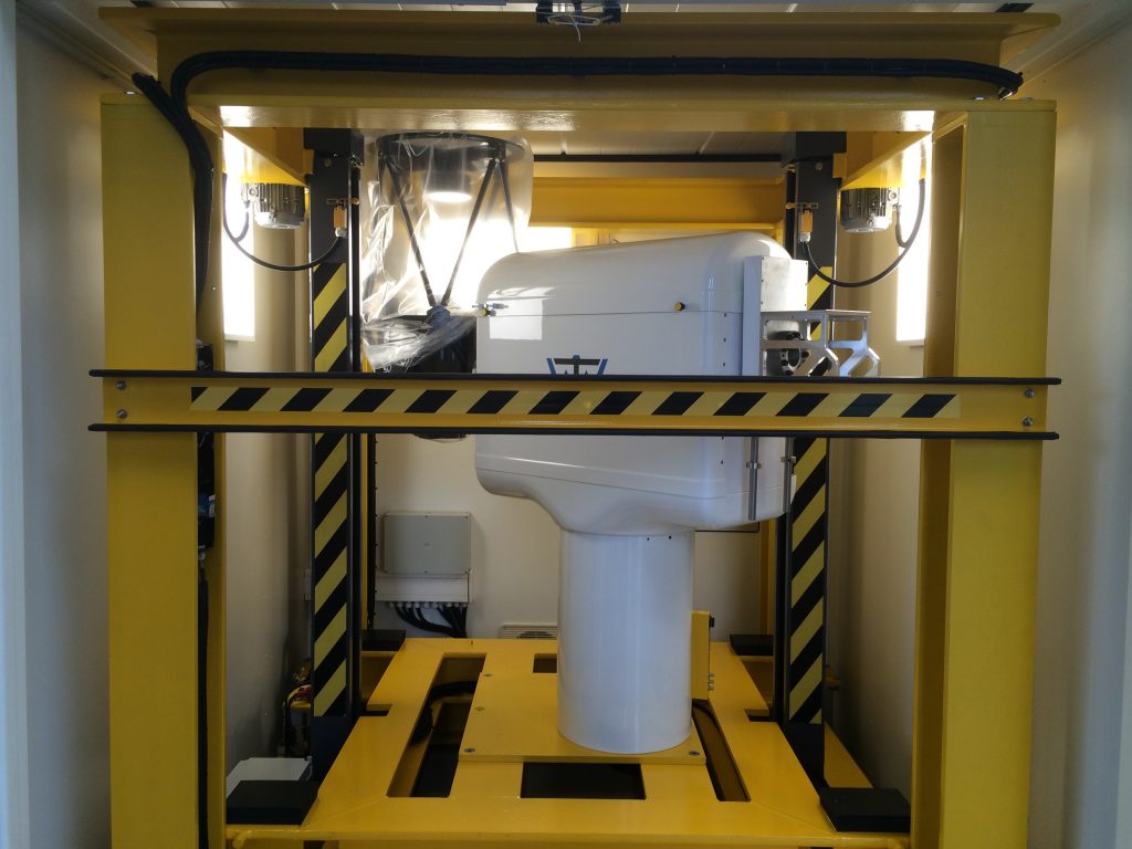
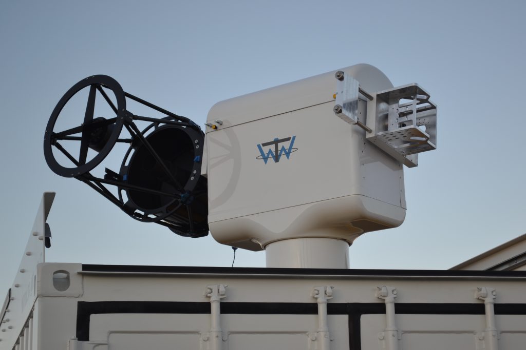
Telescope Mount:
The internal construction is a massive aluminum frame to give high stiffness. Both direct drives are big hollow shaft servo drives with a rated torque of 100 Nm (max. 250 Nm). The inner diameter of the hollow shaft is 100mm. In addition to the internal encoders we are using external absolute encoders with a 26bit resolution on both motors. The absolute encoders are directly connected to the motors. That gives us the high accuracy.
For the unlimited rotation in azimuth we are using a slipring assembly also with a hollow shaft and inner diameter of 50mm. This is the diameter of the coude’ path that could be used for a Laser.
“Satellite Laser Ranging (SLR) is a proven geodetic technique with significant potential for important contributions to scientific studies of the Earth/Atmosphere/Oceans system. It is the most accurate technique currently available to determine the geocentric position of an Earth satellite, allowing for the precise calibration of radar altimeters and separation of long-term instrumentation drift from secular changes in ocean topography.
Its ability to measure the variations over time in the Earth’s gravity field and to monitor motion of the station network with respect to the geocenter, together with the capability to monitor vertical motion in an absolute system, makes it unique for modeling and evaluating long-term climate change by:
– providing a reference system for post-glacial rebound, sea level and ice volume change
– determining the temporal mass redistribution of the solid Earth, ocean, and atmosphere system
– monitoring the response of the atmosphere to seasonal variations in solar heating.
SLR provides a unique capability for verification of the predictions of the theory of general relativity, such as the frame-dragging effect.
SLR stations form an important part of the international network of space geodetic observatories, which include VLBI, GPS, DORIS and PRARE systems. On several critical missions, SLR has provided failsafe redundancy when other radiometric tracking systems have failed.”
(Origin: Wikipedia)
 D5 Creation